Ben More Assynt & Falls of Glomach, 17 August 2025
Conival & Ben More Assynt
The meet started at Inchnadamph on a fine warm August morning. A cloudless sky promised good views from the tops. The midges were also around enjoying the weather.
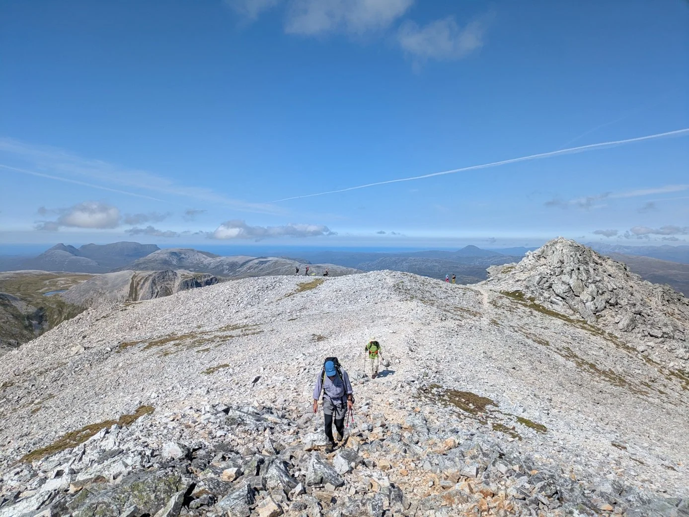
Hugh, Gavin, Stela, May, Emma, Gill, Kieran, Richard, Martyn and dogs Orla and Bran started up Gleann Dubh past the sign to the Traigill Caves. The path was good, and progress was quickly made. The route then turned northeast to the bealach below the summit of Conival. The burn flowing alongside the path was very welcome to wash sweaty heads and arms as the temperature was rising. The Bealach was gain with a minor scramble over a quartzite rock band. This fortunately dry as wet quartzite is not pleasant.
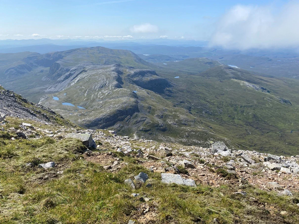
The summit of Conival (adjoining hill) was reached where first lunch was taken. The views were excellent. The summits of Ben hope, Foinaven, Canisp, Suilven, Cul More and even Ben Wyvis were spotted. Seeing across the far north of Scotland made the climb worthwhile.
The summit of Ben More Assynt (Big hill of Assynt – Assynt from the Norse, Ridge End) was then gained following a rocky quartzite ridge. Second lunch was taken.
The route down was a reverse of the ascent, again the burn was welcome, refreshing hot bodies.

Words: Martyn; Photos: Emma, May, Stela, Kieran,
Taking Part: Kieran, Martyn, Stela, Richard, May, Gavin, Hugh, with prospective members Emma & Gill, and dogs Orla & Bran..

Falls of Glomach
On Sunday, 17th August 2025 a small group of us ventured out to see one of the tallest waterfalls in Scotland, Falls of Glomach located north east from Morvich, Kintail.
The route to the waterfall is part of the Cape Wrath Trail, Morvich to Maol-bhuidhe leg. It can be reached only on food and trail from Morvich takes about 3h each way.With total elevation gain about 1100m and distance of about 9km each way.
Knowing the route from my previous escapades along aforementioned Cape Wrath Trail I decided to take the whole group to the waterfall itself, spend some time around the top to enjoy the views, take photos and potentially enjoy a dip in the river above the waterfall. Then, optionally take part of the route down the waterfall, along the trail and turn back when the whole group decides we had enough.
Route on OS Maps Explorer
Our group met in Morvich by the Kintail Outdoor Centre where the trail starts. ( From the left: Erik, Armin, myself, Anna, Daniel and John.)
First part of the trail is a pretty easy 3km walk through cattle grounds and fields along Abhainn Chonaig river and then Dorusduain Wood on loggers road until we reached a step ascent to a trail along the south slopes of An t-Sròin.
Weather was more than perfect, and even though heat was making the walk a bit difficult, the views compensated everything and everyone seemed to enjoy the hike.

That part was almost 2km long. Then the trail later turned left just West of Meall Dubh and after a short break for drinks and snacks we’ve continued our walk towards the waterfall for another 3km.
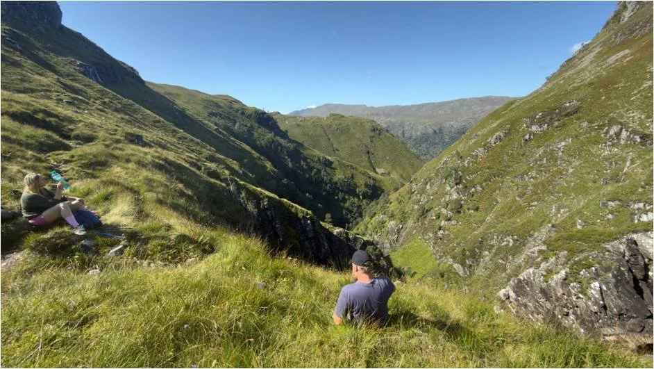
At this point many probably questioned their decision about joining the hike, as the trail suddenly turned into a long and steep descent towards the waterfall and the vision of having to climb that hill later on the way back looked like a nightmare.
Fortunately the view from the waterfall, combined with a beautiful sun and surprisingly warm water in the river above the waterfall instantly improved everyone’s mood and no one thought about how tired they are or will be later.
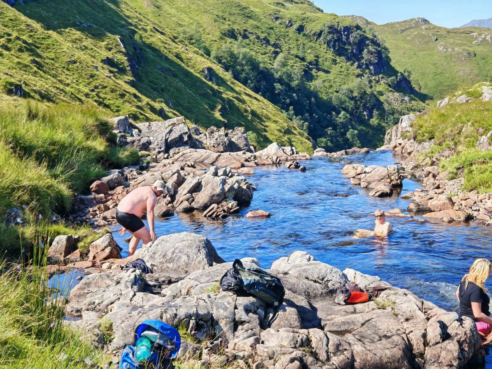

The river above the waterfall is quite well shielded from the waterfall with massive boulders and creates a lot of ponds deep enough to completely without taking any risks.
After couple of hours of relaxing in water and having lunch, we decided to take part of the trail heading north down the waterfall. This part was a bit more challenging and more technical, but dry conditions and lack of wind allowed us to reach the main viewpoint just below the waterfall and then another one about half a kilometer down the river below the waterfall.
Walking this path you have to be careful and mind your steps, as the path is narrow and goes above a 100+ meters slope with nothing to stop you if you slip and start tumbling down.
Then, we decided to finally turn around and make our way back to our parking spot.
At the end of the trail everyone was extremely tired but happy, which made me, a person who proposed that trail and led the group, very very happy and proud of everyone who participated.
I highly recommend this trail to anyone who likes to see some truly epic views. It’s worth doing the way we did it, as a one day hike to the waterfall and back, but also as part of a longer multiday hike as I have done it before walking the Cape Wrath Trail. Heavy backpack makes it much harder, but opportunity to experience sunset and sunrise around the waterfall is worth it!

Words: Janusz;
Taking part: John, Daniel and prospective members Janusz, Armin, Anna, Erik